Hurricane watch is up for the east coast
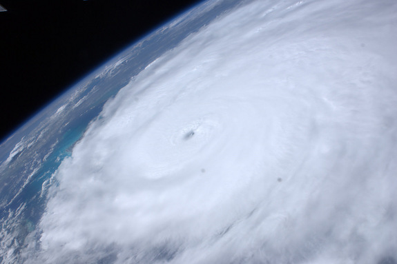
Hurricane Irene has been getting a lot of attention lately because its track is set to affect about 55 million people all along the East Coast. The hurricane should weaken after it hits Long Island, NY but it will still remain a powerhouse even as it enters New England.
The eye of the storm is now rated at a category 1 with sustained winds of 100mph. Even if the storm gets downgraded to a tropical storm, it’s not the winds that are of the greatest concern but the flooding because the ground is already saturated from all the rain in the past 2 weeks. The soft soil also makes it more likely for trees to fall over which are the main cause of power outages. Meteorologists expect 6-12 inches of rain (up to 15 in some localities) to be dumped as it passes by at 14mph.
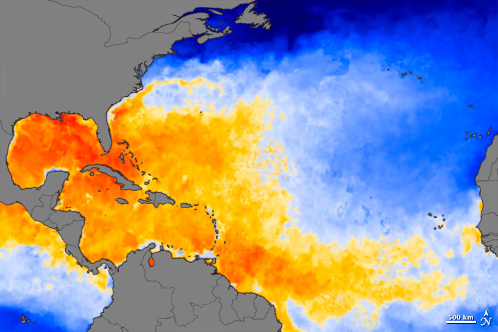
A hurricane is powered by warm water and there is plenty of it during this time of year. The water in NY/NJ is about 10-12 degrees cooler than the water in South Carolina but the flooding will still be an issue as it is coincidentally hitting that area during the highest possible tide. This is a very rare event for the Northeastern US and considered a once-in-a-generation type event. The last hurricane that made it to NYC and beyond was Hurricane Gloria in 1985 which made it up to Canada and was reason for the creation of the Canadian Hurricane Center. I once heard Canada’s four seasons go like this: Winter. Winter. Winter. Construction.


Well I hope you guys found that interesting because I sure did. There’s not much variety in our weather for California as it’s pretty much just hot in the summer and perfect the rest of the year.
Now for some comic relief
